|
1883 Union and Confederate veterans of Wilson’s Creek see Col. W. H. Merritt, commander of First Iowa Regiment led by Lyon in the charge, dedicate monument to Lyon, Aug. 9. Ladies Park Association proposes fountains and shrubs around monument. |
 |
HISTORY OF PARK CENTRAL SQUARE Revised 10/26/70 L.W.R.
1835 John Polk Campbell plats the city, with a public square in his native Columbia, Tennessee.
1836 Campbell deeds 2 acres for the Public Square, including a two-story, red brick court house built in the center, with proceeds of 48 other acres deeded by Campbell to the county.
1857 A three-story court house is built on site of present Heer store.
1858 The Butterfield Overland Stage Line begins 24-day service from end of railroad at Tipton, Mo., to San Francisco. A water well is dug for Fire department.
1861 The court houses were used for the Union Army hospitals after the Battle of Wilson’s Creek, Aug. 10. Union Gen. Nathaniel Lyon was killed while leading a charge against Confederates under Gen. Sterling Price, former Governor of Missouri. First major battle west of Mississippi saves wealthy Missouri—fifth in total population—for the Union.
1861 Major Zagonyi’s Raiders charge into city ahead of Gen. John C. Fremont’s Union Army, causing a deranged man to set fire which destroys 1836 court house, Oct. 25
1863 Confederates under Gen. John Sappinton Marmaduke (later Governor of Missouri) fail to reach square in attacks up St. Louis and South streets against Union troops of Gen. Egbert B. Brown, in Battle of Springfield, Jan. 8. [Note: John Rutherford states the attacks were on Jefferson and South streets.]
1865 James Butler (Wild Bill) Hickok, former union Army scout and spy, later a famous marshal at Fort Riley, Hays City and Abilene and a scout for Custer in the Indian wars, kills Dave Tutt at 50 yards after Tutt fires first, while hundreds watch.
1867 Fire destroys several buildings.
1871 Wooden bell tower and band platform built in center, removed in 1882.
|
1883 Union and Confederate veterans of Wilson’s Creek see Col. W. H. Merritt, commander of First Iowa Regiment led by Lyon in the charge, dedicate monument to Lyon, Aug. 9. Ladies Park Association proposes fountains and shrubs around monument. |
|
1885 Farm wagons damage iron fence around monument. Monument removed to National Cemetery, to join the fallen of Wilson’s Creek, Fence to McAfee home on Cherry.
1886 Gen. William Tecumseh Sherman speaks at annual Wilson’s Creek reunion.
1887 The well is filled and abandoned.
1889 The Public Square is paved with gravel.
1895 Gottfried Tower is erected, an iron structure with a Statue of Liberty at the top and a band platform ten feet above the base.
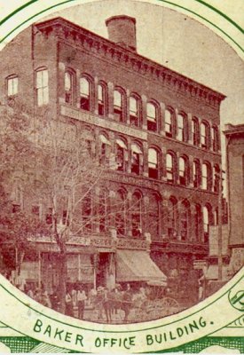
1894 postcard of the Baker Building |
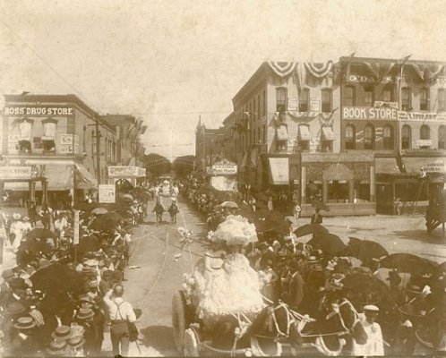
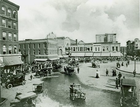
A view of the south square, circa 1904 |
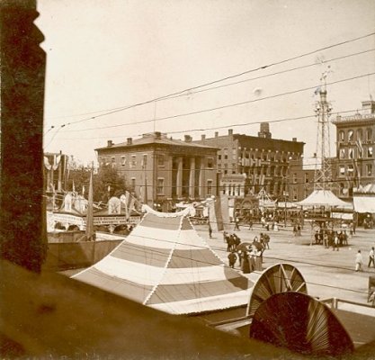 |
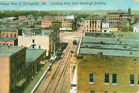
A view of the northwest corner, taken before 1908. Looks like
|
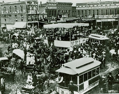
1909 Federation of Women’s Clubs proposes a flower garden. Gottfried Tower replaced by the “Pie”—a round concrete slab circled by trolley tracks. Square is paved with Buffalo Blocks made in Buffalo, Kansas.
1913 Fire destroys all buildings in northeast quadrant, including Heer Dry Goods Co.

1913 Square, view northeast |
1913 Square, view southeast |
1914 Second court house replaced by new Heer’s.
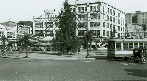
The famous "Pie!" That's right -- it was "The Pie, our Square...." |
A bird's-eye view of The Pie, sans Christmas Tree |
1932 Harland Bartholomew of St. Louis prepared master city plan with fountain and landscaped circle for Square; recommends improved streets and parking.
1940 Bartholomew commissioned to design a fountain and landscaping.
1943 Citizens defeat bonds for $50,000 design by Bartholomew.
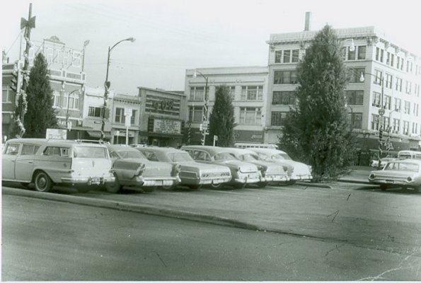
1947 The “Pie” is removed. New traffic pattern has crossroads movement through center, bus and car movement around perimeter, and 11 parking places in each quadrant.
|
1964 Planning Commission approves Comprehensive Metropolitan Plan by Planning department. Master plan for downtown by Ladislas Sehoe and Associates of Cincinnati proposes semi-mall treatment for Square and a civic cultural, entertainment and convention center spanning Boonville, north of Olive. |
|
1965 Public meeting of 125 civic leaders sees slides of full-scale downtown pedestrian malls in other cities. City council is among 82 Ozarkian leaders who fly to inspect four cities with downtown malls. Planning department proposes “tuning fork” one-way loop, to permit full scale mall. Downtown Springfield Association is organized.
1966 Public dinner of 300 civic leaders sees pictures of civic progress and malls in other cities. Federal Department of housing and Urban Development awards planning grant to Springfield’s Redevelopment Authority.
1967 New plan by Urban Programming Corp. o St. Louis includes full-scale mall.
1968 Voters defeat bonds for a $13.5 million convention “industry” and entertainment center, which would have released a federal grant for a complete downtown renewal project with pedestrian mall.
1969 Downtown Association agrees to finance major beautification of Squae and approach streets. Park and Shop free parking plan begins.
1970 Federal Department of Housing and Urban Development grants $1 million for first stage of tuning fork street loop. Downtown Association pledges exceed half million. Council approves design for a full-scale pedestrian plaza with enclosed two-story canopy, by Lawrence Halprin and Associates of San Francisco. Fountain, gazebo and first stage of pedestrian plaza are built.
1971 First stage of canopy built. Tuning fork street system and much new parking is added.
1972 Mall system is completed.
For more information, check out these links.
Page created and copyrighted 2007, With A Twist Creations.
Last updated: 9 October 2007